It's run by DSfisher and has a little bit of everything but is mainly focused on africa. I'm not sure if its due to your profile settings but I cant dm you for some reason so you might have to start a convo.to clarify, is this a discord just for Africa maps? Because I'd be interested
You are using an out of date browser. It may not display this or other websites correctly.
You should upgrade or use an alternative browser.
You should upgrade or use an alternative browser.
The one issue I saw with your fantastic map was the lack of a Maravi Empire.@Yanranay I had no idea this resource was here, would have made my 1885 map so much better.
Ah well
Had no idea it existed, thank you for the infoThe one issue I saw with your fantastic map was the lack of a Maravi Empire.
Since there seems to be renewed interest in the topic I'd like to reopen this thread for people to post.
I dunno if anyone would consider it necroing even without your post, since it's just helpful resources and stuff. Still, looking forward to more contributions here

A roughly accurate map of West Africa at the zenith of the Empire of Mali, showing spheres of influence, vassals, later occupations and surrounding states ,drawn on paper X: Tribe T0: City-State Dotted line: Approximated border Faded colour: Undefined border 0: City Date: 1420 A.D., 15th century A.D.
Hand drawn map of 16th century west africa
This one from.


From
African Diaspora Maps
All materials are free to use and rename under a Creative Commons Attribution 4.0 International License. Please add tagline, "Courtesy of Henry B. Lovejoy, African Diaspora Maps Ltd." Source: Henry B. Lovejoy, Paul E. Lovejoy, Walter Hawthorne, Edward A. Alpers, Mariana Candido, Matthew S...
 hlovejoy.wordpress.com
From
African Diaspora Maps
All materials are free to use and rename under a Creative Commons Attribution 4.0 International License. Please add tagline, "Courtesy of Henry B. Lovejoy, African Diaspora Maps Ltd." Source: Henry B. Lovejoy, Paul E. Lovejoy, Walter Hawthorne, Edward A. Alpers, Mariana Candido, Matthew S...


I'd like to take a shot at doing a WorldA patch for the top map and Q-BAM for the bottom1727


Didn't know the Azande formed a Kingdom. What book is it from?.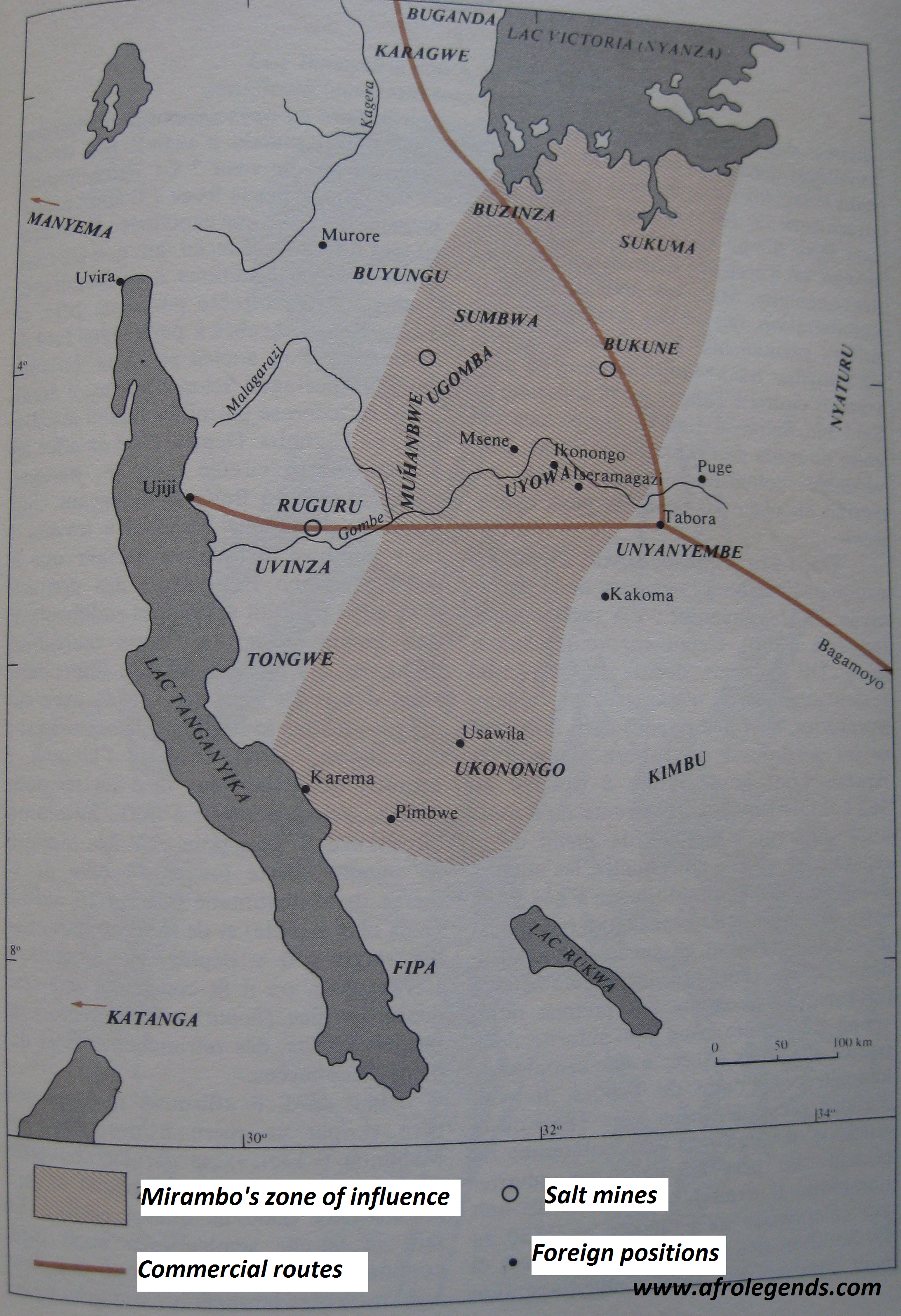
Map of Mirambo's kingdom, ~1880

South-east tanzania, 1880, from
Social Organization and Social Status in Nineteenth and Twentieth Century Rukwa, Tanzania, Tony Waters

Another map of the region, from
A history of Tanzania, Isaria N Kimambo; A J Temu , 1967(modifié)

Early 18th century Interlacustrine kingdoms

second half of the 19th century interlacustrine kingdoms
From
History of Africa Podcast: February 2021
From Cairo to Cape Town, learn more about the History of Africa from this educational and entertaining historical podcast
historyofafricapodcast.blogspot.com
linkYeah I kind of stopped updating this as it pretty tedious to catalogue and upload maps on here, especially considering the rather small upload limit. Due to that I've mostly switched to using discord servers. If you have an account and would like an invite feel free to dm me.


Last edited:
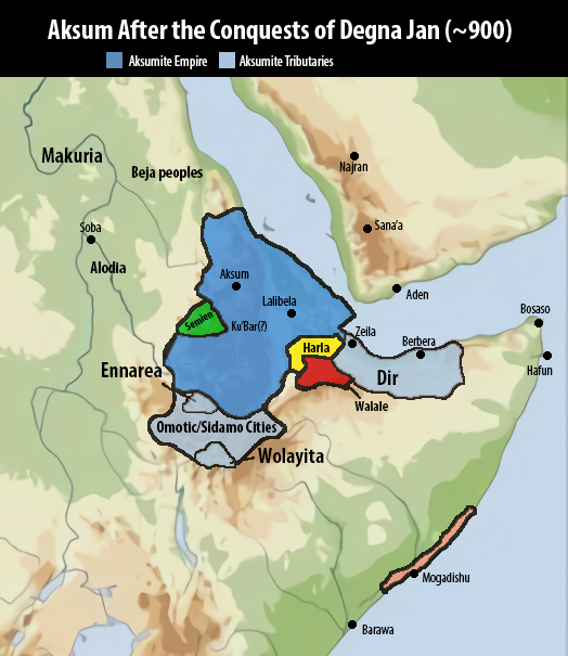
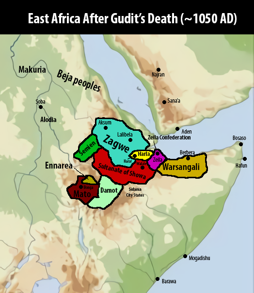
Historical and present areas inhabited by the Oromo:


Source: "Integration and Peace in East Africa" by Tsega Etefa, 2012 (High-quality pictures found on Facebook of all places lol)
Source: "Integration and Peace in East Africa" by Tsega Etefa, 2012 (High-quality pictures found on Facebook of all places lol)
Share: