You are using an out of date browser. It may not display this or other websites correctly.
You should upgrade or use an alternative browser.
You should upgrade or use an alternative browser.
The HEART Development and Core Thread
- Thread starter JG Online
- Start date
-
- Tags
- basemap blank maps cartography maps

Patch for unofficial HEART addon:
- Irevan Governorate
- Tiflis Governorate
- Elizavetpol Governorate
- Baku Governorate
- Dagestan Oblast
- Zaqatala Okrug
- Kutaisi Governorate
- Kuban Oblast
- Sukhumsky Okrug
- Kars Oblast
- Batumi Okrug
- Sochi Okrug of Black Sea
- Don Host Oblast
- Congress Poland
**Color from Worlda Map


- Irevan Governorate
- Tiflis Governorate
- Elizavetpol Governorate
- Baku Governorate
- Dagestan Oblast
- Zaqatala Okrug
- Kutaisi Governorate
- Kuban Oblast
- Sukhumsky Okrug
- Kars Oblast
- Batumi Okrug
- Sochi Okrug of Black Sea
- Don Host Oblast
- Congress Poland
**Color from Worlda Map
What year is this for? 1914?Patch for unofficial HEART addon:
- Irevan Governorate
- Tiflis Governorate
- Elizavetpol Governorate
- Baku Governorate
- Dagestan Oblast
- Zaqatala Okrug
- Kutaisi Governorate
- Kuban Oblast
- Sukhumsky Okrug
- Kars Oblast
- Batumi Okrug
- Sochi Okrug of Black Sea
- Don Host Oblast
- Congress Poland
**Color from Worlda Map
Yep, though it is sometimes hard to find exactly 1914 maps of regions, some of from wikicommons, but they have a bit fat lines of 2nd lvl, also sometimes they simplified, that makes it inaccurate in some places, but I'm double-checking, so will see the resultsWhat year is this for? 1914?
Yea there is also some resevoirs there that I think didn't exist yet in 1914. What is your source for the lake that will eventually become Tsimlyansk reservoir?Yep, though it is sometimes hard to find exactly 1914 maps of regions, some of from wikicommons, but they have a bit fat lines of 2nd lvl, also sometimes they simplified, that makes it inaccurate in some places, but I'm double-checking, so will see the results
Looks really good for a WIP tho, once the base map is done I will provide some historical patches for the Caspian coastline for you
What is your source for the lake that will eventually become Tsimlyansk reservoir?
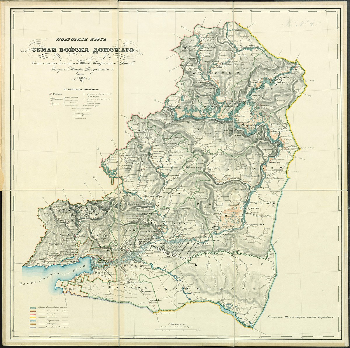
Файл:Detailed map of the Don Cossack Host.jpg — Википедия
The rest of the Bahamas:
- Long Island
- Ragged Island
- Exuma
- Black Point
- Cat Island
- North, Central, and South Eleuthera
- Harbour Island
- Spanish Wells
- New Providence
- North, Central, and South Andros
- Mangrove Cay
- Berry Islands
- Bimini
- North, Central, and South Abaco
- Hope Town
- Moore's Island
- West and East Grand Bahama
- Freeport City
- Grand Cay
2# Patch for unofficial HEART addon:
- Russian Baltics
- Wilno Governorate
- Vitebsk Governorate
- Grodno Governorate
- Bessarabian Governorate / Dniestr river need double-check***
- Grand Duchy of Finland (need double-check)
- All of Malorossiya & Novorossiya (Ukraine territories) / Chernigov Governorate need double-check*** / Dnieper river need double-check***
- Some little fixes of subdivision's borders
Just for remind: this addon is in constant progress, that is, with each patch, the borders will probably constantly change, since I sometimes notice inaccuracies in the process of drawing neighboring regions! If someone wants to help, I have severe difficulties in the north and, possibly, in Siberia
You don't need to call it unofficial btw, this is its own map using the HEART basemap2# Patch for unofficial HEART addon:
OK sounds good.This doesn't really work as I have already finished New Jersey, Pensylvania, Delaware and Maryland, I will leave the other reds to you though as I was planning to follow the coastline south for the time being, so you could still do merenland
Patch #82
The entire eastcoast of the US is done woohoo, almost halfway with the entire US 22/50 states are done!
Added Georgia (not the one with cool mountains and khachapuri)
Added Alabama
Added Mississippi
Added Tennessee
Added Kentucky
Added Florida (credit to Tomoto for the Florida Key's and reefs)

The entire eastcoast of the US is done woohoo, almost halfway with the entire US 22/50 states are done!
Added Georgia (not the one with cool mountains and khachapuri)
Added Alabama
Added Mississippi
Added Tennessee
Added Kentucky
Added Florida (credit to Tomoto for the Florida Key's and reefs)
Will you make Native American Reservations?Patch #82
The entire eastcoast of the US is done woohoo, almost halfway with the entire US 22/50 states are done!
Added Georgia (not the one with cool mountains and khachapuri)
Added Alabama
Added Mississippi
Added Tennessee
Added Kentucky
Added Florida (credit to Tomoto for the Florida Key's and reefs)
View attachment 900316
For the sake of time no, I might add them later when the entire base map is done or someone else can add them insteadWill you make Native American Reservations?
I have also stopped doing glaciers for the time being for the same reason
Here is my first contribution: Ohio, Indiana, and Michigan. The Upper Peninsula has made me hate the ice ages already.

Also @JG Online, my Ohio river isn't quite the same as yours, although on a broad scale it still mostly aligns. Is this an expected result of different tracing techniques? I hope there isn't a flaw in my process somehow. I've been importing the shapefiles directly into g-projector using the "import overlay" function.
Also @JG Online, my Ohio river isn't quite the same as yours, although on a broad scale it still mostly aligns. Is this an expected result of different tracing techniques? I hope there isn't a flaw in my process somehow. I've been importing the shapefiles directly into g-projector using the "import overlay" function.
Last edited:
It's a bit problematic as now our patches can't be mergedHere is my first contribution: Ohio, Indiana, and Michigan. The Upper Peninsula has made me hate the ice ages already.
Also @JG Online, my Ohio river isn't quite the same as yours, although on a broad scale it still mostly aligns. Is this an expected result of different tracing techniques? I hope there isn't a flaw in my process somehow. I've been importing the shapefiles directly into g-projector using the "import overlay" function.
Honestly the shapefile methode is probably better than the way I have been doing it, Are you using the QuickOSM plugin?
If so are you importing the natural->water layer? I believe there should be a few rivers visible in your patch
The way I have been doing it is using the QuickOSM plugin to import administrative and natural features which I then export as an image, I then align those in paint.net to an upscaled 8K-BAM, which I then convert into robinson using g-projector, which I then trace for HEART 🤔
Yes I am using QuickOSM.It's a bit problematic as now our patches can't be merged
Honestly the shapefile methode is probably better than the way I have been doing it, Are you using the QuickOSM plugin?
If so are you importing the natural->water layer? I believe there should be a few rivers visible in your patch
The way I have been doing it is using the QuickOSM plugin to import administrative and natural features which I then export as an image, I then align those in paint.net to an upscaled 8K-BAM, which I then convert into robinson using g-projector, which I then trace for HEART 🤔
I just haven't gotten to the rivers yet.
The method I'm using entirely circumvents the paint.net aligning step, which I couldn't really get the hang of. If you export a layer from qgis as a shapefile, then import that shapefile into g-projector using File -> Import Overlay, and then select it as an overlay, it automatically generates a map in the desired projection.
Surely this is more accurate since it avoids the human error and resolution loss inherent in resizing onto the 8k-bam.
Unfortunately this means the entire map so far is probably off to some degree if people have been using the alignment method 😬
You are right which is why the map has a 4 pixel error margin, honestly I didn't know about the shapefiles methode so non of the current patched have used itYes I am using QuickOSM.
I just haven't gotten to the rivers yet.
The method I'm using entirely circumvents the paint.net aligning step, which I couldn't really get the hang of. If you export a layer from qgis as a shapefile, then import that shapefile into g-projector using File -> Import Overlay, and then select it as an overlay, it automatically generates a map in the desired projection.
Surely this is more accurate since it avoids the human error and resolution loss inherent in resizing onto the 8k-bam.
Unfortunately this means the entire map so far is probably off to some degree if people have been using the alignment method 😬
3# Patch for HEART addon:
- Minsk Governorate
- Mogivel Governorate
- Saint Petersburg Governorate (needs triple-check!!!)
- Pskov Governorate
- German Empire included in this addon
- Austria-Hungary in progress
To be clear: I post these patches here so often that someone can quickly see and tell me if something is very inaccurate, I hope I don't annoy with the frequency of posting xd
Share: