1. Named after the Uruguay riverPart of Rio Grande do Sul is now named Uruguai, bruh moment.
2. To make it more distinct from Rio Grande do Norte (which I renamed Sao Roque for the same reason)
1. Named after the Uruguay riverPart of Rio Grande do Sul is now named Uruguai, bruh moment.
This isn't based on the original Yakko Warner song (which has a lot of errors). It's based on this:I'm guessing French Guiana, Barbados and Guam are all skipped.
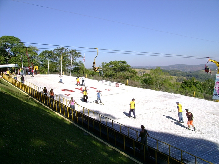
Interesting, the only São Roque that I know is in São Paulo, I loved going there when I was a kid, they had a fake alpine ski resort of the sorts, that was just plastic instead of snow lol.which I renamed Sao Roque for the same reason
Keep on keepin on your path is set I believe in you!Nicaragua (15 departments + 2 autonomous regions -> 13 departments + 2 autonomous departments)
View attachment 901665
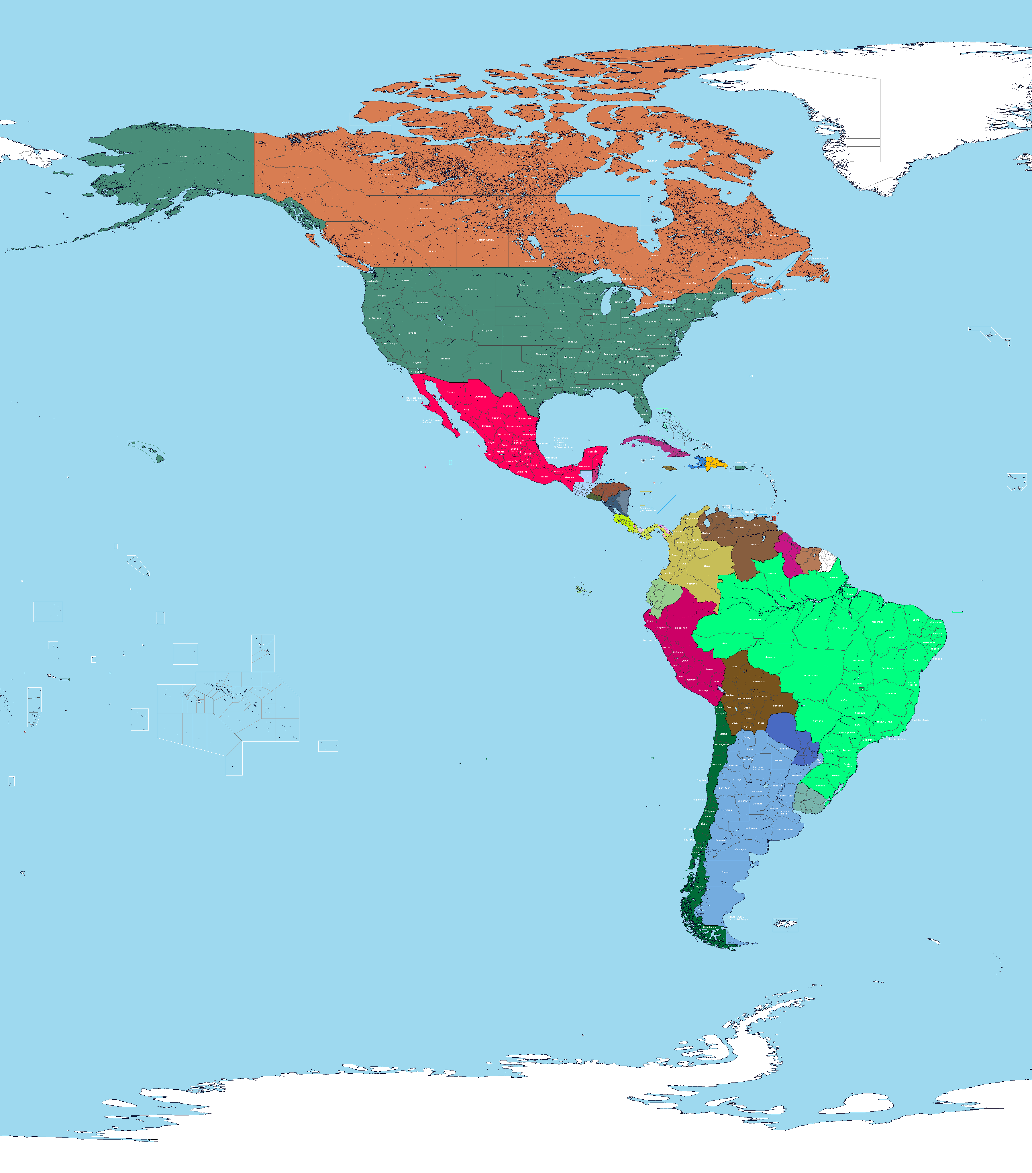
The Americas are now all done. I'll post a progress map soon, then move on to Europe.
Very interesting, although Rhein-Franken has little to do with Franken AFAIK. Maybe a better name would be Rheinpfalz, just Pfalz, Rheinland-Pfalz as in OTL, or even Kurpfalz?Germany (13 states + 3 city-states -> 19 states + 4 city-states)
Sachsen-Anhalt still exist, 0/10./jGermany (13 states + 3 city-states -> 19 states + 4 city-states)
View attachment 902560
To echo @...Clear.As.Christal... , very happy to see a Westfalen. Also happy to see Lübeck, Franken and Braunschweig, and I do like where you've run a lot of the new borders.Germany (13 states + 3 city-states -> 19 states + 4 city-states)
Very nice! To me this setup feels like if there was never a proper French occupation zone established, at most something akin to the way the British handled their occupation zone by having other Western allies (and Poland) establish small zones. All very sensible options.Germany (13 states + 3 city-states -> 19 states + 4 city-states)
I'm just doing these for fun, not necessarily how I think they should be.@erictom333 i reread your OP and it doesn't explain whether or not the changes are just your personal headcanon for how the countries should be organized or if you're designing them based on simplification or something, I'm assuming its just how you feel and not trying to reduce complexity?
So like doodling but you are sharpening your cartography skills? I dig that just watching you makes me nostalgic for when I had the programs and free time to do it myself `~`I'm just doing these for fun, not necessarily how I think they should be.
As I said in the OP, I'm doing this in order to start making maps again. There are other WIP projects I have here though, notably the RDCS color scheme.So like doodling but you are sharpening your cartography skills? I dig that just watching you makes me nostalgic for when I had the programs and free time to do it myself `~`